Working with annotations
For example, planners might want to draw a parade route on the map, or city engineers might want to mark the locations of new street lights. Annotations can be linked to Infor Public Sector records that are displayed on the map, such as permit applications, assets, or service requests.
To open the annotation tool, click and select Drawings. You can also right-click a map marker and select Show Drawing. Infor Public Sector shows the annotation tool, and shows the existing annotations on the map.
The annotation tool is displayed in a popup window with several collapsible tabs. The appearance of the tool and the names of the tabs depend on your agency's configuration. The tool typically includes these tabs:
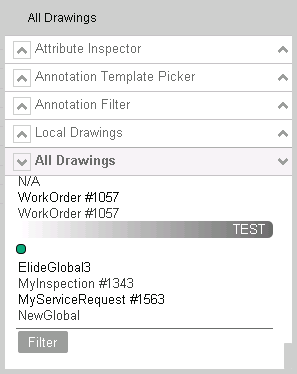
- Feature list tabs show lists of
available annotations. There may be multiple lists using different criteria. For
example, the tool might include a Local
Drawings tab that lists drawings in the current extent, and an
All Drawings tab that
lists all drawings.
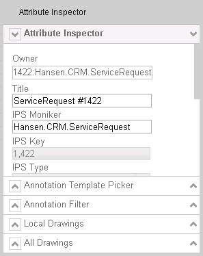
- The attribute inspector shows the
attributes of a selected annotation, such as the type of drawing, the title, and the
record that the drawing is linked to. You can select a drawing from a feature list
to view its attributes, or you can select a drawing on the map.
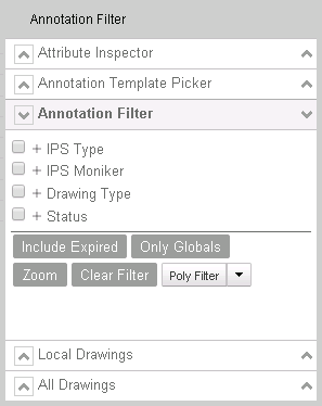
- The filter tab provides options for
filtering the annotations that are displayed on the map. For example, a building
inspector might want to see only annotations that relate to building inspections.
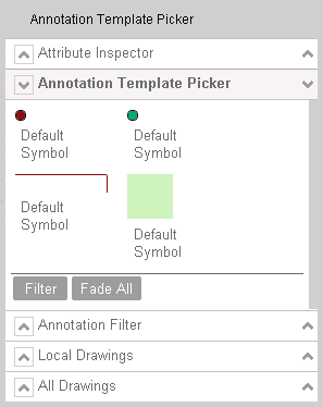
- The template picker is used to add new drawings to the map. You can select different templates to add points, lines, and areas. The available templates are defined by your agency.