GIS enhancements
First, ArcGIS Online feature services are now supported in the Map Browser.
For information about configuration feature services see the Infor Public Sector GIS Administration Guide.
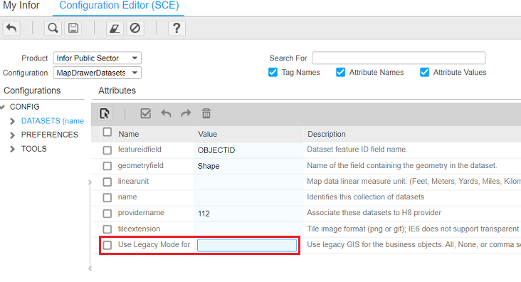
Second, a legacy mode option has been added for GIS synchronization.
When GIS synchronization is enabled, the GIS synchronization tables are used by default to locate all kinds of records. This means that all data must be synchronized before you can successfully locate records in the Map Browser.
If you have not yet synchronized all records, you can use legacy mode instead. Legacy mode uses the original design, where Infor Public Sector address, parcel, or asset keys stored in the GIS are used to locate records in the Map Browser.
To enable legacy mode, use the Use Legacy Mode for attribute on the node in the MapDrawerDatasets configuration. You can enable legacy mode for selected business objects or for all objects.

For example, if you have finished synchronizing addresses but not parcels, you can use legacy mode for parcels only.
See "GIS synchronization" in the Infor Public Sector GIS Administration Guide.