LODS attributes
Use the (level of detail) node to define zoom levels. The node has one or more nodes as children, each of which defines the scale and resolution settings for a level.
Note: Ths information is typically only
required if both of these conditions apply:
- The Spatial Reference attribute of the node is not set to Web Mercator. Web Mercator coordinate systems are 3857, 3758, 900913, 102113, and 102100.
- The cacheurltype attribute of the node indicates that the service is tiled rather than dynamic.
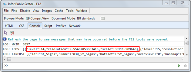
You can obtain the scale and resolution of a map by selecting the Legend tab of the Infor Public Sector GIS map. This action will generate the scale and resolution values for existing layers, which you can view in the browser console log by pressing the F12 key.

Each node has threse attributes:
| Attribute | Description |
|---|---|
| level | Numeric identifier for the zoom level. 0 is the lower limit. There is no upper limit, although higher levels may not be practical. For example, at 26 the scale would be close to 1.0, meaning one inch on the map equals one inch in the real world. |
| resolution | Distance on the ground that is represented by a single pixel in the map. This typically represents the number of meters per pixel. |
| scale | Ratio between map distance and ground distance, when measured in the same units. For example, at a map scale of 1:100000, each inch on the map represents a ground distance of 100,000 inches. |