Maps integration
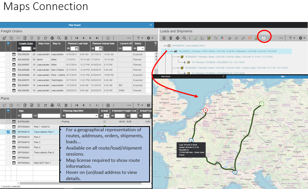
From multiple Freight sessions and some Warehousing sessions, you can now have map-based insight in transport-related operations. This includes the geographical representation of load and unload addresses, standard routes, route plans, (consolidated) shipments, and loads/trips. To monitor the planning and consolidation results produced by the planning engine and to manually fine-tune shipments and loads, proper geographical visibility is indispensable.
When you select a specific route, load, or shipment record in a shipping-related session, for example the Plan Board (fmlbd0215m000) session, and you then click the option or icon, the corresponding map is displayed. This map shows the advised route and the visited shipment addresses. When you hover over an (un)load address, the required dates, times, and address details are displayed.