Applying conditional formatting to a measure on a geomap
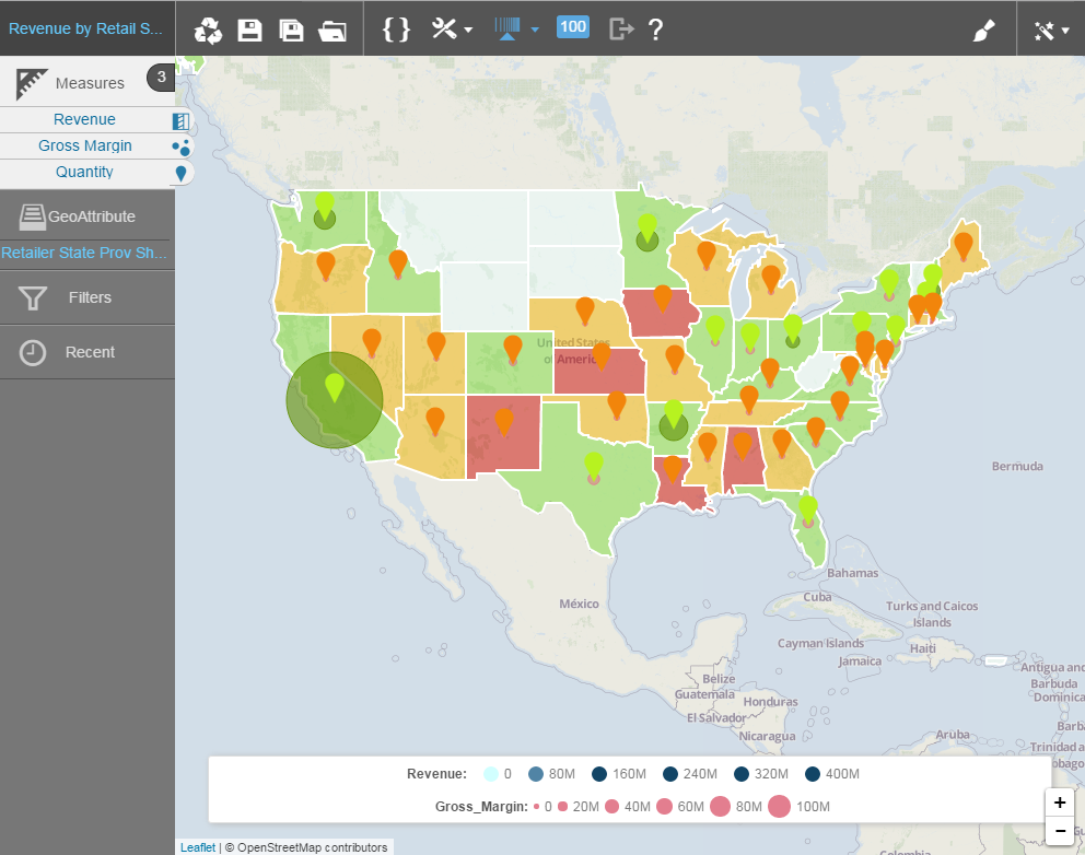
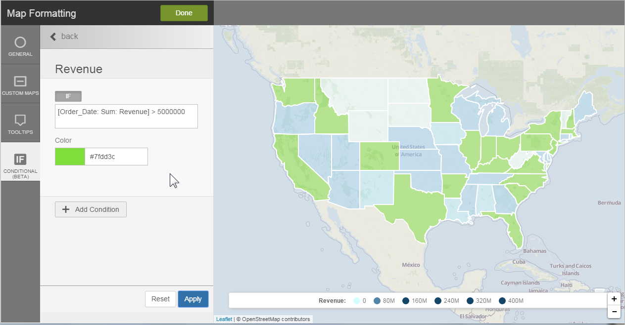
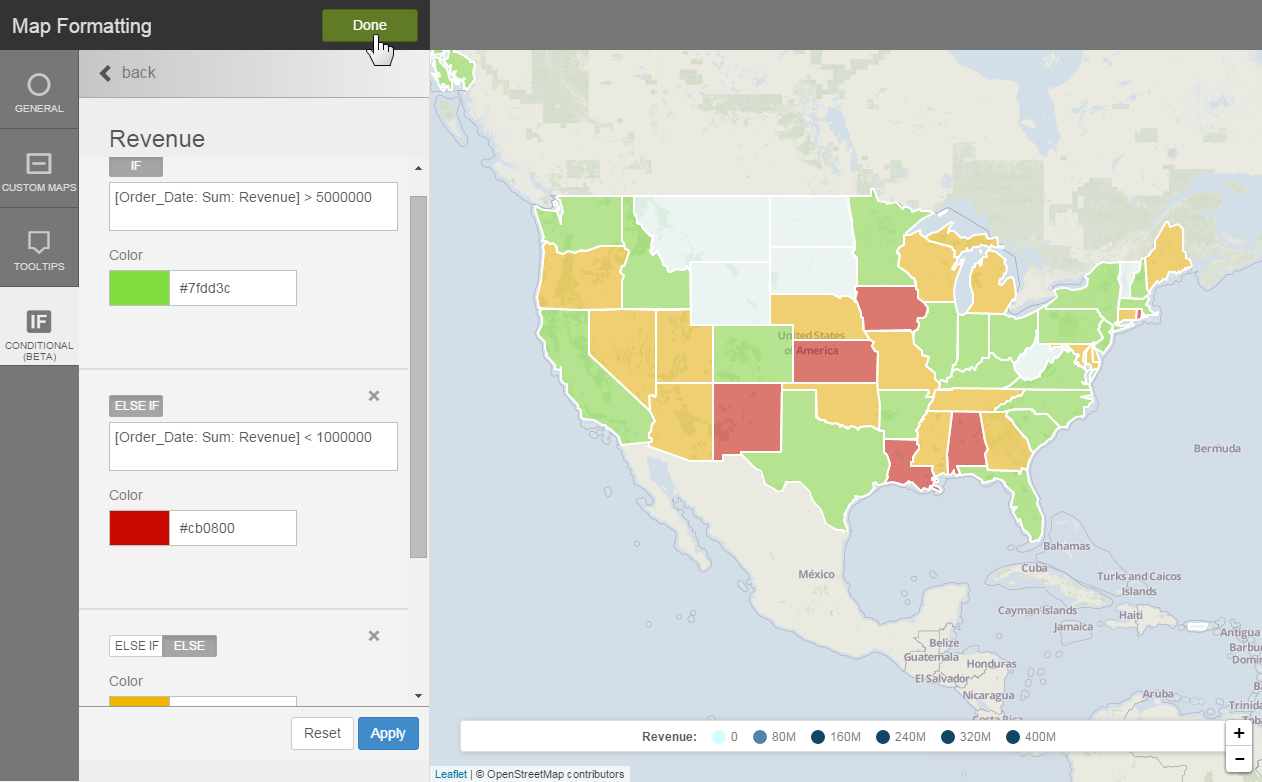
You can apply conditional formatting to geomaps using BQL and IF/ELSE IF/ELSE syntax and color. This applies to any layer type.
This example uses the heatmap layer type:
Note:
- Overlay measures and apply conditional formatting to each for a more interesting visualization.

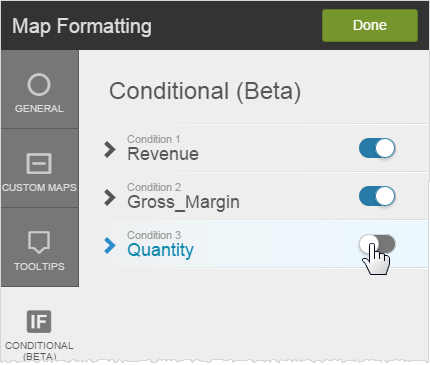
- You can switch conditional formats on and off in the > Conditional tab.


